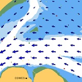
We design tidal stream fields using high sophisticated mathematical models, coastal bathymetrics and GPS based stream measurements.
![]() High resolution tidal stream fields
High resolution tidal stream fields
![]() Grid 100m
Grid 100m
![]() Time pattern 30min
Time pattern 30min
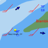
Special GRIB software supplies interface for import of high resolution wind data.
![]() Wind forecast for complete race day
Wind forecast for complete race day
![]() Routing considers forecast of currents and wind
Routing considers forecast of currents and wind
![]() Processes GRIB data from all leading suppliers
Processes GRIB data from all leading suppliers
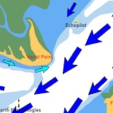
Race Area Analyzer supports eddy currents around some significant points on The Solent. Eddies have been determined by single measurements at
![]() Solent East (Stokes Bay, Stanswood Bay, Cowes East)
Solent East (Stokes Bay, Stanswood Bay, Cowes East)
![]() Solent West (Hurst Point, Sconce, Cowes West)
Solent West (Hurst Point, Sconce, Cowes West)
![]() Various other coastal areas
Various other coastal areas
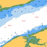
Weak tidal currents below 0.1 kts are indicated as slack waters. Race Area Analyzer gives information about slack water times at any supported sailing location.
![]() Integration of slack waters
Integration of slack waters
![]() Times of changing tides
Times of changing tides
![]() Upcoming currents
Upcoming currents
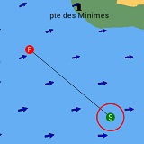
On The Solent: by selecting Solent Racing Marks or movable marks in subsequent order.
Other locations (windward-leeward courses): by either editing course data or using gestures on the phone or tablet.
![]() Double tap close to the mark and move mark (Red circle)
Double tap close to the mark and move mark (Red circle)
![]() Double tap at course center and move whole course
Double tap at course center and move whole course
![]() Double tap again to leave mode
Double tap again to leave mode
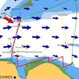
Race Area Analyzer uses a dynamic grid routing algorithm specially developed for beat and run. It performes routing in detail like boats do it in real. The best routing algorithm until now!
![]() Individual calculation of best beat- and run courses
Individual calculation of best beat- and run courses
![]() Integration of boat performance data (polar diagrams)
Integration of boat performance data (polar diagrams)
![]() High resolution routing grid (10m)
High resolution routing grid (10m)
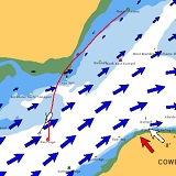
Race Area Analyzer calculates reach courses with the well-known Isochronic Grid Method – improved by algorithms to prevent undesired clusters.
![]() Individual best reach course calculation (Not olympic classes)
Individual best reach course calculation (Not olympic classes)
![]() Integration of boat performance data (polar diagrams)
Integration of boat performance data (polar diagrams)
![]() Isochronic routing grid
Isochronic routing grid
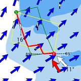
Laylines give informations about the influence of tidal currents on the track to the topmark. Race Area Analyzer displays both laylines with and without currents.
![]() Tactical comparison between current and no current
Tactical comparison between current and no current
![]() Laylines without currents (yellow lines)
Laylines without currents (yellow lines)
![]() Laylines shifted by stream fields (solid green lines)
Laylines shifted by stream fields (solid green lines)
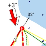
Race Area Analyzer computes the final compass course to the topmark to avoid from under- or overtaking the final track.
![]() Final tack bearing in currents (see dotted line 32°)
Final tack bearing in currents (see dotted line 32°)
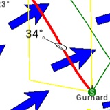
When sailing in tidal currents the angle of attack frequently differs from the course over ground. Knowledge of the angle of attack makes the approach of course marks much safer.
![]() Angle of attack in currents (see 34°)
Angle of attack in currents (see 34°)
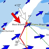
On the boat currents are equivalent to wind. In tidal waters there will be always a wind component caused by currents. Race Area Analyzer computes that wind shift.
![]() True wind (red arrow)
True wind (red arrow)
![]() Wind on the boat (white arrow)
Wind on the boat (white arrow)
![]() Wind shift caused by currents (see +12°)
Wind shift caused by currents (see +12°)
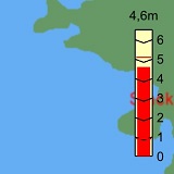
A gauging cylinder gives information about:
![]() High and low tide level
High and low tide level
![]() Current level
Current level
![]() Indicator falling/rising tide
Indicator falling/rising tide
Here: Tide level = currently 4.6 meter, falling. Max tide level today: 5 meters.
(Only for iPad and notebooks/computers.)
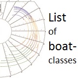
Routing is tailor-made for every type of boat.
![]() more than 950 boat-classes are included
more than 950 boat-classes are included
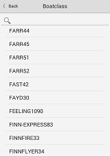
![]() Available boat classes
Available boat classes
![]() if your boat is not listed: we can add
if your boat is not listed: we can add
it if you send us the polar data.
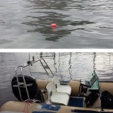
High precision measurements of currents with GPS buoys. Supported by CurrentNow technology.
On the RIB we use:
![]() Toughbook computer
Toughbook computer
![]() GPS transponder
GPS transponder
![]() GSP floating measurement bouy
GSP floating measurement bouy
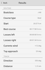
Find results also in exact figures in the results-box.
Compare figures of different routes.
Check speed of currents, VMG and other performance data to gain important information for your race, such as:
![]() Advantage of best course
Advantage of best course
![]() Losses compared to laylines
Losses compared to laylines
![]() Best downwind angle
Best downwind angle
![]() Currents wind shift
Currents wind shift
![]() Topmark approach
Topmark approach
![]() Currents on track
Currents on track
![]() VMG average on track
VMG average on track
![]() VMG minimum on track
VMG minimum on track
Race Area Analyzer comes with polars of most cruiser and racing yachts as well as the Olympic classes 2016 and some keelboats and dinghies.
![]() 950 cruisers and racing yachts
950 cruisers and racing yachts
![]() Olympic classes Rio 2016
Olympic classes Rio 2016
![]() Europe, 505, Starboat
Europe, 505, Starboat
![]() Dragon class, J-70, J-80
Dragon class, J-70, J-80


